MAP - перевод на русский
Diclib.com
Словарь ChatGPT
Введите слово или словосочетание на любом языке 👆
Язык:

Перевод и анализ слов искусственным интеллектом ChatGPT

На этой странице Вы можете получить подробный анализ слова или словосочетания, произведенный с помощью лучшей на сегодняшний день технологии искусственного интеллекта:

  • как употребляется слово
  • частота употребления
  • используется оно чаще в устной или письменной речи
  • варианты перевода слова
  • примеры употребления (несколько фраз с переводом)
  • этимология

MAP - перевод на русский

WIKIMEDIA DISAMBIGUATION PAGE
MAP; Physical map (disambiguation); MAP (disambiguation)
Найдено результатов: 1650
map         
  • Map of [[Utrecht]], Netherlands (1695).
  • left
  • Mean Annual Temperature map of Ohio from "Geography of Ohio" 1923
  • The ''[[Hereford Mappa Mundi]]'', [[Hereford Cathedral]], England, circa 1300, a classic "T-O" map with Jerusalem at the center, east toward the top, Europe the bottom left and Africa on the right
  • In a [[topological map]], like this one showing inventory locations, the distances between locations are not important. Only the layout and connectivity between them matters.
  • CIA World Factbook]]'', 2016
  • Mapa en Relieve de Guatemala
  • Relief map]] of the [[Sierra Nevada]]
  • continental shelves]] and [[oceanic plateau]]s (red), the [[mid-ocean ridge]]s (yellow-green) and the [[abyssal plain]]s (blue to purple)}}
  • Celestial map by the cartographer [[Frederik de Wit]],   17th century
  • ''[[Tabula Rogeriana]]'', one of the most advanced [[early world maps]], by [[Muhammad al-Idrisi]], 1154
  • The Great Polish Map of Scotland at Barony Castle, Scotland
  • Geological map of the Moon
  • USGS]] [[digital raster graphic]].
  • A world map in PDF format.
VISUAL REPRESENTATION OF A CONCEPT SPACE; SYMBOLIC DEPICTION EMPHASIZING RELATIONSHIPS BETWEEN ELEMENTS OF SOME SPACE, SUCH AS OBJECTS, REGIONS, OR THEMES
Maps; Physical map; Political Map; Physical Map; Electronic map; Road atlases; Political map; Maps and directions; Physical map (cartography); Anachronous map; Map generator; Online maps of the united states; Map reading; Village mapping; Map orientation; Interactive Map; Map (cartography); Climatic map; Geographic map

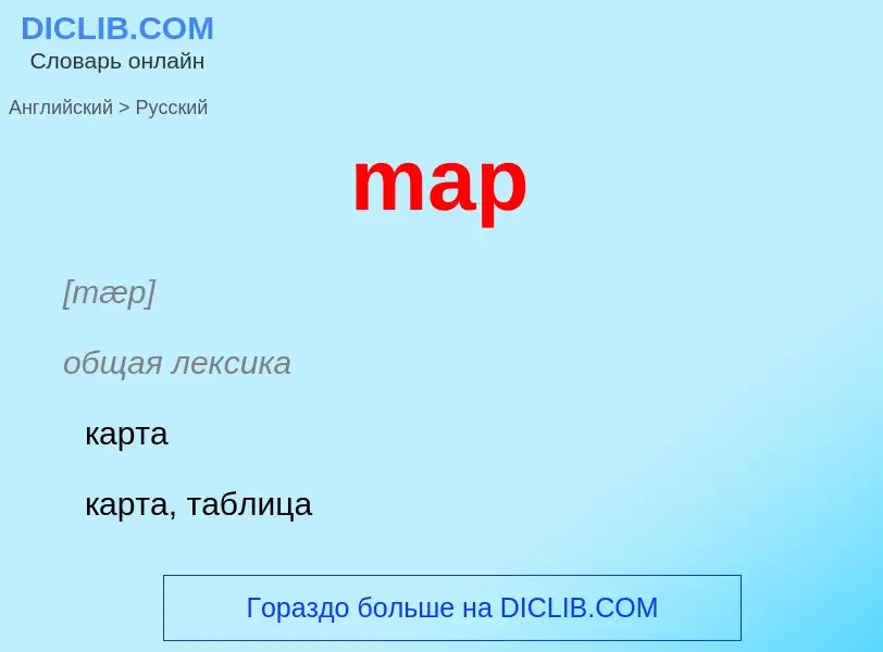
[mæp]

общая лексика

карта

карта, таблица

отображать, устанавливать соответствие

преобразовывать

картографировать

картировать

ландкарта

отображать

отображение

план

нефтегазовая промышленность

составлять карту

существительное

[mæp]

общая лексика

карта (географическая или звёздного неба)

план

биология

генетическая карта

математика

отображение

физика

портрет (движения)

глагол

общая лексика

составлять или чертить карту

наносить на карту

производить съёмку местности

математика

отображать

MAP         
  • Map of [[Utrecht]], Netherlands (1695).
  • left
  • Mean Annual Temperature map of Ohio from "Geography of Ohio" 1923
  • The ''[[Hereford Mappa Mundi]]'', [[Hereford Cathedral]], England, circa 1300, a classic "T-O" map with Jerusalem at the center, east toward the top, Europe the bottom left and Africa on the right
  • In a [[topological map]], like this one showing inventory locations, the distances between locations are not important. Only the layout and connectivity between them matters.
  • CIA World Factbook]]'', 2016
  • Mapa en Relieve de Guatemala
  • Relief map]] of the [[Sierra Nevada]]
  • continental shelves]] and [[oceanic plateau]]s (red), the [[mid-ocean ridge]]s (yellow-green) and the [[abyssal plain]]s (blue to purple)}}
  • Celestial map by the cartographer [[Frederik de Wit]],   17th century
  • ''[[Tabula Rogeriana]]'', one of the most advanced [[early world maps]], by [[Muhammad al-Idrisi]], 1154
  • The Great Polish Map of Scotland at Barony Castle, Scotland
  • Geological map of the Moon
  • USGS]] [[digital raster graphic]].
  • A world map in PDF format.
VISUAL REPRESENTATION OF A CONCEPT SPACE; SYMBOLIC DEPICTION EMPHASIZING RELATIONSHIPS BETWEEN ELEMENTS OF SOME SPACE, SUCH AS OBJECTS, REGIONS, OR THEMES
Maps; Physical map; Political Map; Physical Map; Electronic map; Road atlases; Political map; Maps and directions; Physical map (cartography); Anachronous map; Map generator; Online maps of the united states; Map reading; Village mapping; Map orientation; Interactive Map; Map (cartography); Climatic map; Geographic map

общая лексика

(Message Administration Procedures) [программные] процедуры управления сообщениями [связного тестера MGTS SS7]

(Manageability, Availability, Performance) "управляемость, надежность, производительность"

концепция компании Hewlett-Packard

map         
  • Map of [[Utrecht]], Netherlands (1695).
  • left
  • Mean Annual Temperature map of Ohio from "Geography of Ohio" 1923
  • The ''[[Hereford Mappa Mundi]]'', [[Hereford Cathedral]], England, circa 1300, a classic "T-O" map with Jerusalem at the center, east toward the top, Europe the bottom left and Africa on the right
  • In a [[topological map]], like this one showing inventory locations, the distances between locations are not important. Only the layout and connectivity between them matters.
  • CIA World Factbook]]'', 2016
  • Mapa en Relieve de Guatemala
  • Relief map]] of the [[Sierra Nevada]]
  • continental shelves]] and [[oceanic plateau]]s (red), the [[mid-ocean ridge]]s (yellow-green) and the [[abyssal plain]]s (blue to purple)}}
  • Celestial map by the cartographer [[Frederik de Wit]],   17th century
  • ''[[Tabula Rogeriana]]'', one of the most advanced [[early world maps]], by [[Muhammad al-Idrisi]], 1154
  • The Great Polish Map of Scotland at Barony Castle, Scotland
  • Geological map of the Moon
  • USGS]] [[digital raster graphic]].
  • A world map in PDF format.
VISUAL REPRESENTATION OF A CONCEPT SPACE; SYMBOLIC DEPICTION EMPHASIZING RELATIONSHIPS BETWEEN ELEMENTS OF SOME SPACE, SUCH AS OBJECTS, REGIONS, OR THEMES
Maps; Physical map; Political Map; Physical Map; Electronic map; Road atlases; Political map; Maps and directions; Physical map (cartography); Anachronous map; Map generator; Online maps of the united states; Map reading; Village mapping; Map orientation; Interactive Map; Map (cartography); Climatic map; Geographic map
map 1. noun 1) карта (географическая или звездного неба) 2) rare план - off the map - on the map to put on the map прославить, сделать известным to put oneself on the map а) появиться; б) выдвинуться 2. v. наносить на карту, чертить карту; производить съемку местности - map out
MAP         
  • Map of [[Utrecht]], Netherlands (1695).
  • left
  • Mean Annual Temperature map of Ohio from "Geography of Ohio" 1923
  • The ''[[Hereford Mappa Mundi]]'', [[Hereford Cathedral]], England, circa 1300, a classic "T-O" map with Jerusalem at the center, east toward the top, Europe the bottom left and Africa on the right
  • In a [[topological map]], like this one showing inventory locations, the distances between locations are not important. Only the layout and connectivity between them matters.
  • CIA World Factbook]]'', 2016
  • Mapa en Relieve de Guatemala
  • Relief map]] of the [[Sierra Nevada]]
  • continental shelves]] and [[oceanic plateau]]s (red), the [[mid-ocean ridge]]s (yellow-green) and the [[abyssal plain]]s (blue to purple)}}
  • Celestial map by the cartographer [[Frederik de Wit]],   17th century
  • ''[[Tabula Rogeriana]]'', one of the most advanced [[early world maps]], by [[Muhammad al-Idrisi]], 1154
  • The Great Polish Map of Scotland at Barony Castle, Scotland
  • Geological map of the Moon
  • USGS]] [[digital raster graphic]].
  • A world map in PDF format.
VISUAL REPRESENTATION OF A CONCEPT SPACE; SYMBOLIC DEPICTION EMPHASIZING RELATIONSHIPS BETWEEN ELEMENTS OF SOME SPACE, SUCH AS OBJECTS, REGIONS, OR THEMES
Maps; Physical map; Political Map; Physical Map; Electronic map; Road atlases; Political map; Maps and directions; Physical map (cartography); Anachronous map; Map generator; Online maps of the united states; Map reading; Village mapping; Map orientation; Interactive Map; Map (cartography); Climatic map; Geographic map
Mobile Application Part
прикладная часть (подсистема) контроля MS. Служит для межсетевой сигнализации между MSC с одной стороны и LR и EIR с другой. Определяет сигнальные функции, поддерживающие контроль оборудования.
В GPRS PLMN функции MAP расширены для удовлетворения требований интерфейсов SGSN - HLR/AC и SGSN - SMS GMSC/IWMSC, в частности, для передачи информации по абонентской подписке и информации о зоне маршрутизации.
map         
  • Map of [[Utrecht]], Netherlands (1695).
  • left
  • Mean Annual Temperature map of Ohio from "Geography of Ohio" 1923
  • The ''[[Hereford Mappa Mundi]]'', [[Hereford Cathedral]], England, circa 1300, a classic "T-O" map with Jerusalem at the center, east toward the top, Europe the bottom left and Africa on the right
  • In a [[topological map]], like this one showing inventory locations, the distances between locations are not important. Only the layout and connectivity between them matters.
  • CIA World Factbook]]'', 2016
  • Mapa en Relieve de Guatemala
  • Relief map]] of the [[Sierra Nevada]]
  • continental shelves]] and [[oceanic plateau]]s (red), the [[mid-ocean ridge]]s (yellow-green) and the [[abyssal plain]]s (blue to purple)}}
  • Celestial map by the cartographer [[Frederik de Wit]],   17th century
  • ''[[Tabula Rogeriana]]'', one of the most advanced [[early world maps]], by [[Muhammad al-Idrisi]], 1154
  • The Great Polish Map of Scotland at Barony Castle, Scotland
  • Geological map of the Moon
  • USGS]] [[digital raster graphic]].
  • A world map in PDF format.
VISUAL REPRESENTATION OF A CONCEPT SPACE; SYMBOLIC DEPICTION EMPHASIZING RELATIONSHIPS BETWEEN ELEMENTS OF SOME SPACE, SUCH AS OBJECTS, REGIONS, OR THEMES
Maps; Physical map; Political Map; Physical Map; Electronic map; Road atlases; Political map; Maps and directions; Physical map (cartography); Anachronous map; Map generator; Online maps of the united states; Map reading; Village mapping; Map orientation; Interactive Map; Map (cartography); Climatic map; Geographic map
1) карта (географическая)
2) карта отображения
map         
  • Map of [[Utrecht]], Netherlands (1695).
  • left
  • Mean Annual Temperature map of Ohio from "Geography of Ohio" 1923
  • The ''[[Hereford Mappa Mundi]]'', [[Hereford Cathedral]], England, circa 1300, a classic "T-O" map with Jerusalem at the center, east toward the top, Europe the bottom left and Africa on the right
  • In a [[topological map]], like this one showing inventory locations, the distances between locations are not important. Only the layout and connectivity between them matters.
  • CIA World Factbook]]'', 2016
  • Mapa en Relieve de Guatemala
  • Relief map]] of the [[Sierra Nevada]]
  • continental shelves]] and [[oceanic plateau]]s (red), the [[mid-ocean ridge]]s (yellow-green) and the [[abyssal plain]]s (blue to purple)}}
  • Celestial map by the cartographer [[Frederik de Wit]],   17th century
  • ''[[Tabula Rogeriana]]'', one of the most advanced [[early world maps]], by [[Muhammad al-Idrisi]], 1154
  • The Great Polish Map of Scotland at Barony Castle, Scotland
  • Geological map of the Moon
  • USGS]] [[digital raster graphic]].
  • A world map in PDF format.
VISUAL REPRESENTATION OF A CONCEPT SPACE; SYMBOLIC DEPICTION EMPHASIZING RELATIONSHIPS BETWEEN ELEMENTS OF SOME SPACE, SUCH AS OBJECTS, REGIONS, OR THEMES
Maps; Physical map; Political Map; Physical Map; Electronic map; Road atlases; Political map; Maps and directions; Physical map (cartography); Anachronous map; Map generator; Online maps of the united states; Map reading; Village mapping; Map orientation; Interactive Map; Map (cartography); Climatic map; Geographic map
flexible cause/announcement mapping - гибкая привязка объявления к причине (разъединения/ ошибки)
mapping of the national signaling system - схема преобразования (номера) национальной системы сигнализации
Different subsets of the digit tree can be mapped in the MSC to four different types of Operator Specific Barring. - Различные подмножества цифрового дерева привязываются в MSC к четырем различным типам запрета, характерного для конкретного оператора.
mapping MSU and MMU command keys to the TRM -
отображение функций командных клавиш MSU и MMU на клавиатуре TRM
Each combination of destination number and time type is mapped to a single tariff. - Каждой комбинации номера назначения и типа времени соответствует один тариф.
If the CD-ROM is on a network, mount the СD-ROM and create a mapping to the CD-ROM drive. - Если CD-ROM находится на другом сетевом элементе, установите CD-ROM и укажите путь к CD-ROM дисководу.
map         
  • Map of [[Utrecht]], Netherlands (1695).
  • left
  • Mean Annual Temperature map of Ohio from "Geography of Ohio" 1923
  • The ''[[Hereford Mappa Mundi]]'', [[Hereford Cathedral]], England, circa 1300, a classic "T-O" map with Jerusalem at the center, east toward the top, Europe the bottom left and Africa on the right
  • In a [[topological map]], like this one showing inventory locations, the distances between locations are not important. Only the layout and connectivity between them matters.
  • CIA World Factbook]]'', 2016
  • Mapa en Relieve de Guatemala
  • Relief map]] of the [[Sierra Nevada]]
  • continental shelves]] and [[oceanic plateau]]s (red), the [[mid-ocean ridge]]s (yellow-green) and the [[abyssal plain]]s (blue to purple)}}
  • Celestial map by the cartographer [[Frederik de Wit]],   17th century
  • ''[[Tabula Rogeriana]]'', one of the most advanced [[early world maps]], by [[Muhammad al-Idrisi]], 1154
  • The Great Polish Map of Scotland at Barony Castle, Scotland
  • Geological map of the Moon
  • USGS]] [[digital raster graphic]].
  • A world map in PDF format.
VISUAL REPRESENTATION OF A CONCEPT SPACE; SYMBOLIC DEPICTION EMPHASIZING RELATIONSHIPS BETWEEN ELEMENTS OF SOME SPACE, SUCH AS OBJECTS, REGIONS, OR THEMES
Maps; Physical map; Political Map; Physical Map; Electronic map; Road atlases; Political map; Maps and directions; Physical map (cartography); Anachronous map; Map generator; Online maps of the united states; Map reading; Village mapping; Map orientation; Interactive Map; Map (cartography); Climatic map; Geographic map
1) карта (географическая)
2) бюллетень
3) наносить на карту
map         
  • Map of [[Utrecht]], Netherlands (1695).
  • left
  • Mean Annual Temperature map of Ohio from "Geography of Ohio" 1923
  • The ''[[Hereford Mappa Mundi]]'', [[Hereford Cathedral]], England, circa 1300, a classic "T-O" map with Jerusalem at the center, east toward the top, Europe the bottom left and Africa on the right
  • In a [[topological map]], like this one showing inventory locations, the distances between locations are not important. Only the layout and connectivity between them matters.
  • CIA World Factbook]]'', 2016
  • Mapa en Relieve de Guatemala
  • Relief map]] of the [[Sierra Nevada]]
  • continental shelves]] and [[oceanic plateau]]s (red), the [[mid-ocean ridge]]s (yellow-green) and the [[abyssal plain]]s (blue to purple)}}
  • Celestial map by the cartographer [[Frederik de Wit]],   17th century
  • ''[[Tabula Rogeriana]]'', one of the most advanced [[early world maps]], by [[Muhammad al-Idrisi]], 1154
  • The Great Polish Map of Scotland at Barony Castle, Scotland
  • Geological map of the Moon
  • USGS]] [[digital raster graphic]].
  • A world map in PDF format.
VISUAL REPRESENTATION OF A CONCEPT SPACE; SYMBOLIC DEPICTION EMPHASIZING RELATIONSHIPS BETWEEN ELEMENTS OF SOME SPACE, SUCH AS OBJECTS, REGIONS, OR THEMES
Maps; Physical map; Political Map; Physical Map; Electronic map; Road atlases; Political map; Maps and directions; Physical map (cartography); Anachronous map; Map generator; Online maps of the united states; Map reading; Village mapping; Map orientation; Interactive Map; Map (cartography); Climatic map; Geographic map
отображать; устанавливать соответствие
map         
  • Map of [[Utrecht]], Netherlands (1695).
  • left
  • Mean Annual Temperature map of Ohio from "Geography of Ohio" 1923
  • The ''[[Hereford Mappa Mundi]]'', [[Hereford Cathedral]], England, circa 1300, a classic "T-O" map with Jerusalem at the center, east toward the top, Europe the bottom left and Africa on the right
  • In a [[topological map]], like this one showing inventory locations, the distances between locations are not important. Only the layout and connectivity between them matters.
  • CIA World Factbook]]'', 2016
  • Mapa en Relieve de Guatemala
  • Relief map]] of the [[Sierra Nevada]]
  • continental shelves]] and [[oceanic plateau]]s (red), the [[mid-ocean ridge]]s (yellow-green) and the [[abyssal plain]]s (blue to purple)}}
  • Celestial map by the cartographer [[Frederik de Wit]],   17th century
  • ''[[Tabula Rogeriana]]'', one of the most advanced [[early world maps]], by [[Muhammad al-Idrisi]], 1154
  • The Great Polish Map of Scotland at Barony Castle, Scotland
  • Geological map of the Moon
  • USGS]] [[digital raster graphic]].
  • A world map in PDF format.
VISUAL REPRESENTATION OF A CONCEPT SPACE; SYMBOLIC DEPICTION EMPHASIZING RELATIONSHIPS BETWEEN ELEMENTS OF SOME SPACE, SUCH AS OBJECTS, REGIONS, OR THEMES
Maps; Physical map; Political Map; Physical Map; Electronic map; Road atlases; Political map; Maps and directions; Physical map (cartography); Anachronous map; Map generator; Online maps of the united states; Map reading; Village mapping; Map orientation; Interactive Map; Map (cartography); Climatic map; Geographic map
карта; картограмма; картодиаграмма
- consumption map
- cost map
- forecast map
- indifference map
- quality map
- resource map
- yield map

Википедия

Map (disambiguation)

A map is a symbolic visual representation of an area.

Map or MAP may also refer to:
Как переводится map на Русский язык